La Cañada Real - From Informal Settlement to Neighbourhood (2017-18)
Sophie Schrattenecker
Once a thriving transhumance route, the Cañada Real Galiana on the outskirts of Madrid presents a different picture today. Since the 1960s, the approximately 70-metre-wide drove road has gradually been built up along both sides, evolving into what is now the largest informal settlement in Europe. The settlement's location on a historic livestock route, as well as at the intersection of three municipal jurisdictions, created a political grey area that enabled its emergence in the first place. While the Cañada is frequently portrayed in the media as dangerous and neglected, its residents have organised themselves into community advocacy groups to defend their homes. Although the construction of new housing estates and major infrastructure projects in the vicinity is intended by the authorities to ease political tensions, the resulting physical barriers have instead led to the increasing isolation of individual neighbourhoods within the settlement.
Developed in collaboration with Madrid's Office of the Commissioner for the Cañada Real, the project investigates how the settlement could be integrated as a legal urban district within Spain's growing capital. Field research, together with the analysis of demographic data and historical aerial imagery, made it possible to identify three distinct urban typologies within the Cañada: Detached Spanish houses alternate with encampments of urban Roma communities (gitanos) and densely built Maghrebi neighbourhoods.
To counteract the growing physical boundaries between the Cañada and its surroundings, the project develops the potential of three existing urban situations within the settlement: a marketplace in the Arab quarter, a sports ground on the deck above the motorway, and a serviced site for urban nomadic communities. Each proposal builds upon the characteristics of the existing urban typologies while promoting the long-term integration of the Cañada into the future urban development of the Greater Madrid metropolitan area.
Planning partners: -
Client: In cooperation with the Comisionado del Gobierno de la Comunidad de Madrid para la Cañada Real
Categories: Building Redevelopment, Housing, Historic Preservation, Urban Development, New Construction, Science and Research
Project Gallery
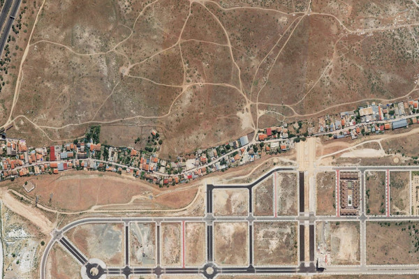
01 La Canada sector 2.jpg
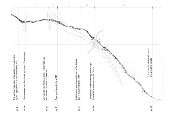
02 La Canada site plan showing all 6 sectors.jpg
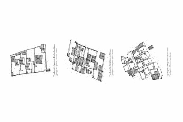
03 La Canada building typologies hand drawing.jpg
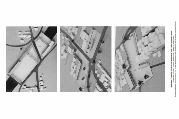
04 La Canada physical models of designs for 3 urban areas.jpg
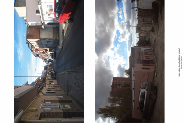
05 La Canada photographs sector 1 and 5.jpg
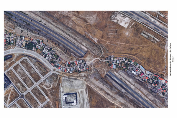
06 La Canada aerial image sector 3.jpg
Sophie Schrattenecker AT
http://sophieschrattenecker.com
Zeinlhofergasse 7/17 | 1050 Wien